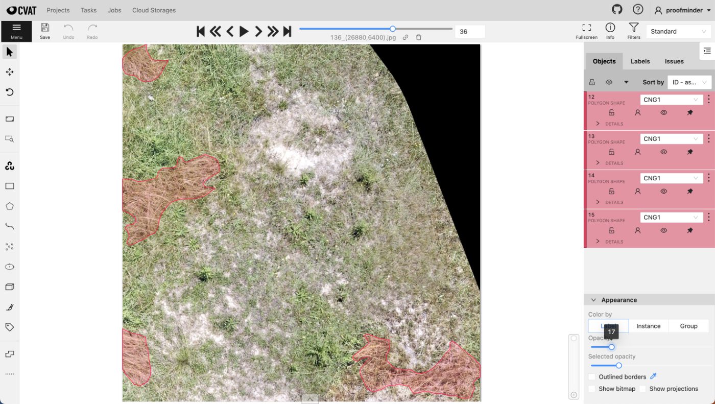
Aerial Orthomosaic Segmentation
Whole-site orthomosaics segmented into vegetation, water and bare ground across tiles stitched from multiple flights.
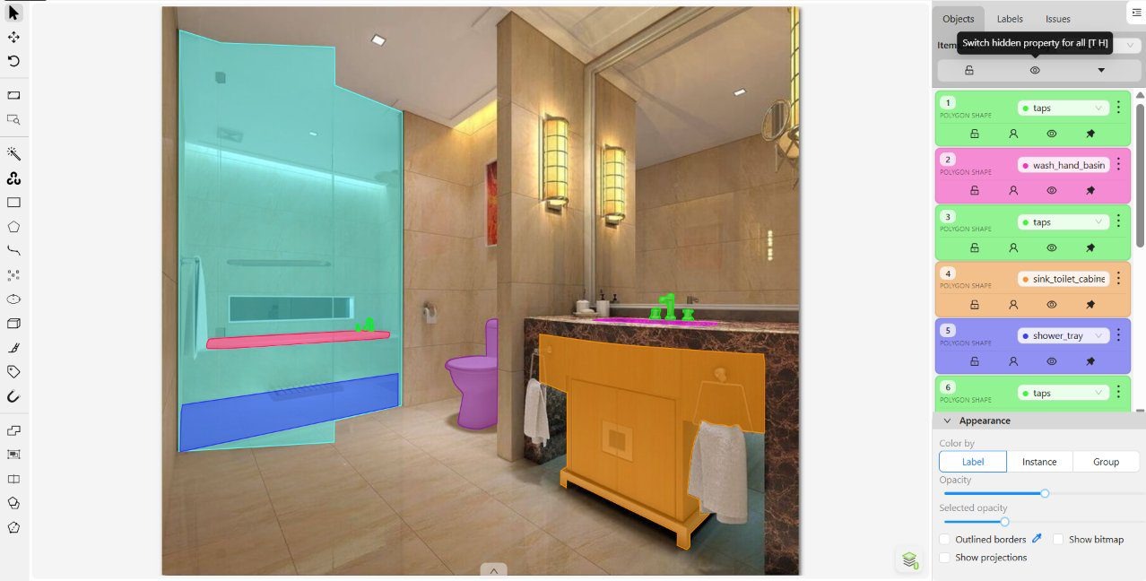 BEFORE / AFTER
Bathroom Surface Segmentation
Tiling, sanitaryware and vanity units separated per surface, through the glare and reflections bathrooms are full of.
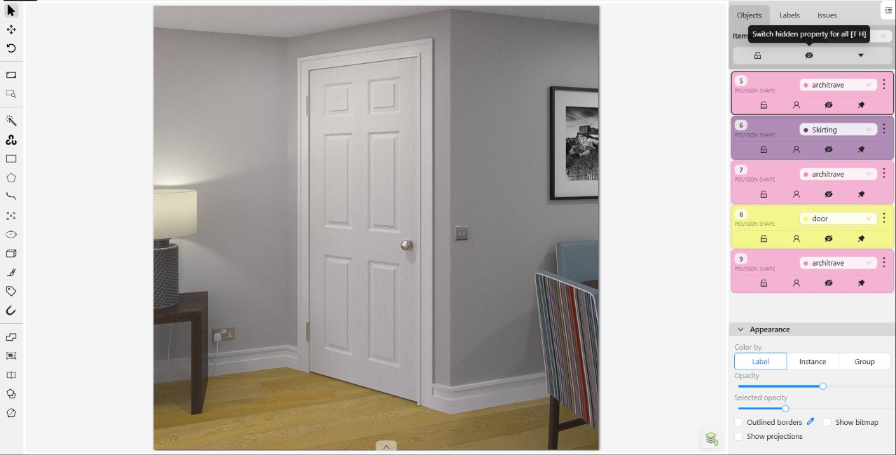 BEFORE / AFTER
Door & Frame Segmentation
Door leaf, frame, architrave and skirting separated as four classes so each can be refinished on its own.
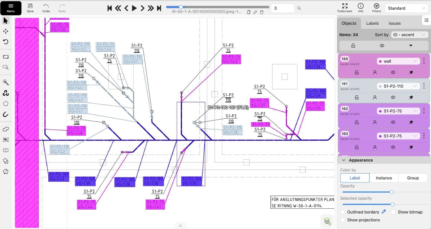 BEFORE / AFTER
Engineering Drawing Segmentation
Rooms, service runs and annotation blocks marked out on CAD floor plans so drawings can be parsed automatically.
 BEFORE / AFTER
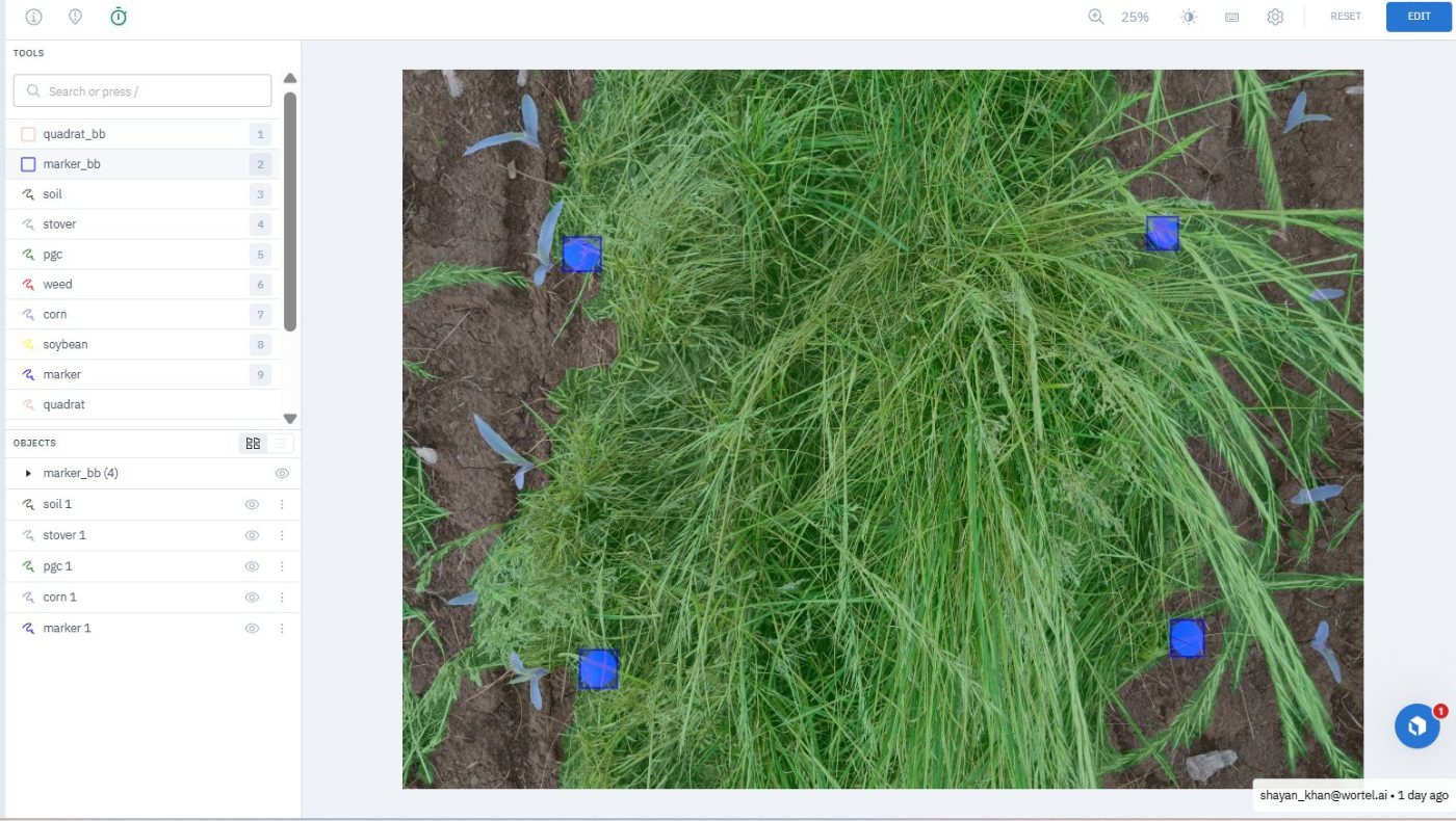
Ground Cover Quadrat Segmentation
Green cover, residue and bare soil segmented inside survey quadrats, with the quadrat frame itself located per image.
 BEFORE / AFTER
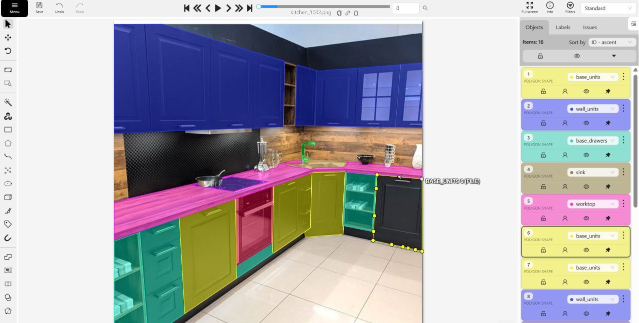
Kitchen Surface Segmentation
Every cabinet face, worktop, splashback and floor in a listing photo cut as its own editable region.
 BEFORE / AFTER
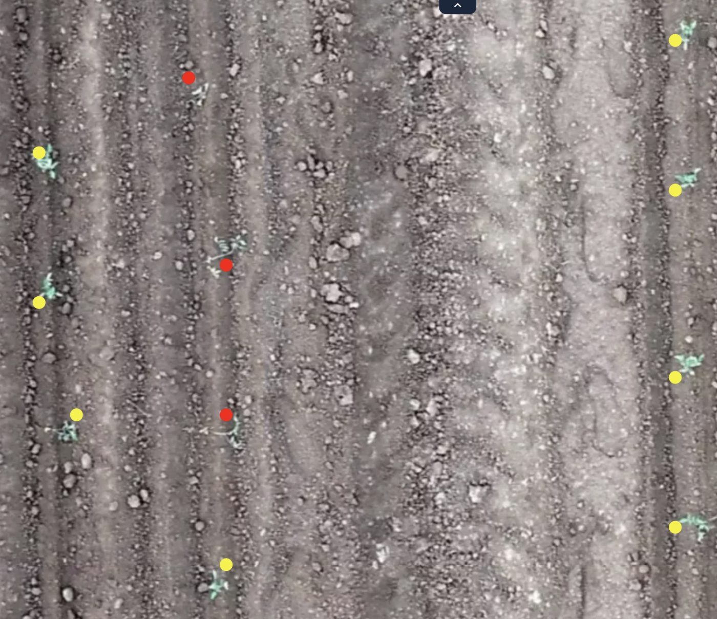
Tomato Stand Count (Key Points)
One point per plant across drone orthomosaics, marking emergence and gaps along thousands of metres of row.
Almond Tree Detection
Bounding boxes around individual almond trees in top-down drone imagery, where shadows and neighbouring vegetation mimicked real trees.
Apple Detection
Bounding boxes around individual apples on tree branches, where dense leaves and occlusion hid much of each fruit.
Bin Fill Level Estimation
Estimating waste bin occupancy by eye across ten thousand images and encoding each percentage into the filename.
Black Grass Segmentation
Polygon masks isolating black grass from crops and similar-looking grasses across dense agricultural field imagery.
Blueberry Plant Segmentation
Polygon masks tracing blueberry plants through dense foliage, overlapping branches and look-alike vegetation in open field conditions.
Broccoli Stand Count
Bounding boxes on individual broccoli plants for automated stand counting, separating closely packed plants from surrounding weeds.
Cabbage Detection
Bounding boxes on cabbage plants across varied growth stages, dense vegetation and cluttered field backgrounds.
Cabbage Size Classification
Bounding boxes plus small, medium or large size labels on each cabbage, judged consistently despite shifting camera distance.
Cabbage Trunk Detection
Bounding boxes on cabbage trunks that were small, irregularly shaped and frequently obscured by overhanging leaves.
Carrot Segmentation
Polygon masks following carrot crop boundaries along long field rows, through dense and irregular vegetation.
Chilean Needle Grass Segmentation
Polygon masks outlining Chilean needle grass, a thin-leaved weed easily confused with the grasses growing around it.
Corn Detection & Growth Stage Classification
Bounding boxes separating large and small corn plants from weeds and ambiguous vegetation across complex field imagery.
Corn Stand Count
Individual corn plants boxed for stand counting, with no plant missed or counted twice in dense field rows.
Cotton Detection & Size Classification
Cotton bolls boxed and split into regular and small classes among dense leaves, branches, and heavy occlusion.
Cotton Segmentation
Polygon masks tracing cotton plants while excluding weeds of similar shape, colour, and leaf structure growing alongside them.
Datura Stramonium Detection
Datura stramonium plants boxed in dense field imagery where similar-looking weeds and vegetation made identification difficult.
Detasseling: Male & Female Tassel Detection
Tassels boxed as male or female by position relative to the crop row, quantifying female tassels left after detasseling.
Face Blur & Picture Frame Detection
Picture frames masked and faces boxed in property photos, separating real faces from artwork for automatic privacy blurring.
Garlic Detection & Counting
Small, densely packed garlic plants boxed individually so that every plant in the field could be counted.
Garlic Segmentation
Precise polygon masks around small garlic plants with thin, elongated leaves that frequently overlapped in dense vegetation.
Grape FD Leaf Detection
Grapevine leaves boxed as confirmed or suspected Flavescence doree cases, separating subtle symptoms from healthy foliage.
Grape Segmentation
Polygon masks around individual grapes and clusters, where fruit overlaps tightly and hides behind vineyard foliage.
Indore Dharmesh Tree Detection
Bounding boxes around individual trees in outdoor scenes where canopies merge and backgrounds mix buildings, roads and crops.
Johnson Grass Detection
Bounding boxes marking Johnson grass against other field vegetation that looks much the same at a glance.
Lanata Weed Segmentation
Polygon masks isolating Lanata weeds from crops, grass and soil in dense field vegetation with overlapping leaves.
Licence Plate Detection
Rotated four-point polygons around licence plates as small as 12 px, for automatic blurring in property photography.
Milk Thistle Segmentation
Polygon masks tracing irregular milk thistle plants among crops, weeds and soil across varied field conditions.
Onion Head Detection
Bounding boxes around onion heads that sit small, partly buried and easily confused with soil and leaves.
Orange Detection & Ripeness Classification
Bounding boxes grading fallen oranges as rotten, ripe or green, where colour and decay cues shift with the light.
Palm Oil Fruit Classification
Bounding boxes sorting palm oil fruits into four ripeness and quality grades separated by subtle colour differences.
Palm Tree Detection
Bounding boxes separating palm trees from other species across outdoor scenes with overlapping canopies and mixed backgrounds.
Pea Detection
Bounding boxes marking pea plants across mixed field vegetation, including small, overlapping and partially hidden plants.
Pea Segmentation
Polygon masks tracing individual peas, keeping round, overlapping and closely packed objects properly separated.
POA Detection
Bounding boxes locating Poa grass among visually similar grasses and dense field backgrounds.
POA Segmentation
Polygon masks outlining Poa plants, separating thin, irregular grass shapes from surrounding crops and weeds.
Poultry Chick Counting
Bounding boxes on individual chicks for automated counting, including crowded groups where birds overlap heavily.
Railway Object Detection
Bounding boxes across five railway asset classes, from coins and bolts to cable poles and signage.
Rape Plant & Soil Segmentation
Polygon masks dividing rape plants from bare soil, with precise boundaries across uneven field textures.
Rosaly Valwater Lettuce Detection
Bounding boxes around individual lettuce plants in field imagery, separating the crop from weeds, soil and mixed vegetation.
Sky Segmentation & Mask Preparation for Sky Replacement
Refined binary sky masks for property photographs, holding clean edges around rooftops, trees and poles for realistic sky replacement.
Solanum Nigrum Weed Detection
Bounding boxes marking Solanum nigrum at varied growth stages, separating it from crops, grass and lookalike weeds.
St. John's Wort Detection
Bounding boxes marking St. John's Wort in dense field imagery, telling the weed apart from visually similar crops and grass.
St. John's Wort Segmentation
Polygon masks tracing St. John's Wort leaves in dense vegetation, excluding overlapping grass, crops and look-alike weeds.
Stick Recognition
Bounding boxes around thin sticks and wooden debris in field imagery, separated from crop stems, branches and dry vegetation.
Sugar Beet Size Classification
Bounding boxes around sugar beets with a small, medium or large size label applied consistently across varying camera distances.
Sugar Cane Detection
Bounding boxes on thin, densely packed sugar cane stalks to support stand counting and crop growth monitoring.
Sunflower & Sclerotinia Detection
Bounding boxes marking sunflower plants and Sclerotinia-affected areas across varied lighting, plant sizes and field environments.
Sunflower Head & Plant Detection
Bounding boxes on sunflower heads, falling back to the whole plant whenever the flower head was not clearly visible.
Sunflower Plant Detection
Bounding boxes around individual sunflower plants in dense field imagery shot at varying distances and viewing angles.
Sunflower, Ragweed & Grass Segmentation
Polygon masks separating sunflower, ragweed and grass across dense, mixed field vegetation.
Syngenta Weed Control, Lapley Fields
Polygon masks separating black grass from rye grass in dense field vegetation, down to overlapping leaves and part-hidden weeds.
Tassel Detection
Bounding boxes for tassels, Johnson grass, shrubs, dried leaves and garbage in dense, overlapping field vegetation.
Terra Weed Segmentation
Polygon masks isolating weeds from crops, soil and surrounding vegetation across dense, overlapping field scenes.
Thistle & Johnsongrass Detection
Bounding boxes around thistle and johnsongrass weeds growing among corn plants at varied growth stages.
Thistle Detection
Bounding boxes locating thistle plants in drone field imagery, told apart from crops, grass and other weeds.
Tobacco Damaged Leaf Count
Bounding boxes separating normal from damaged tobacco leaves, with every visible leaf captured for accurate counting.
Tobacco Stand Count
Bounding boxes around individual tobacco plants for stand counting in dense fields with closely overlapping growth.
Tomato Plant Detection
Bounding boxes around tomato plants in dense fields, separating crop from weeds across varied growth stages.
Tomato Plant Health Detection
Bounding boxes classifying tomato plants as healthy or damaged, where early damage signs are barely visible.
Trash Detection
Bounding boxes around small trash items scattered among crops, soil and weeds in agricultural fields.
Vadodara Catch Trees
Polygon masks around catch tree canopies, separated from neighbouring trees, buildings and dense overlapping foliage.
Vole Hole Detection
Bounding boxes marking small vole holes across agricultural fields, where soil patches, rocks and shadows mimic the target.
Waldersey Black Grass Segmentation
Polygon masks isolating black grass in dense crop fields, where lookalike grasses and overlapping leaves blur plant boundaries.
Waste Object Detection
Bounding boxes across fourteen waste categories inside crowded bins, with small, overlapping and partly occluded items throughout.
Weed Detection, Comberton Field
Polygon masks separating black grass from rye grass in dense field vegetation, where the two species look nearly identical.
Wheat Detection
Bounding boxes on individual wheat plants sorted by visible leaf count, across overlapping plants and mixed growth stages.
Wild Animal Detection
Bounding boxes on wild animals in natural terrain, many small, distant or partly hidden behind vegetation and shadow.
Young Plant & Flower Detection
Bounding boxes on young flower plants at early growth stages, when few visual features separate them from weeds.
Need something that is not on this list?
Send two hours of video or a few hundred images with your taxonomy. You get labelled data back, a QA report with the error taxonomy, and the questions we would ask before scaling.